


|
|
|
|
|
 |
 |
|
|
|
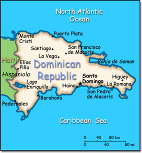
Official Name: Dominican Republic Location: Caribbean, eastern two-thirds of the island of Hispaniola, between the Caribbean Sea and the North Atlantic Ocean, east of Haiti. Capital: Santo Domingo
Lowest point: Lago Enriquillo -46 m Highest point: Pico Duarte 3,175 m |
|
||||||||||||
|
Population: 10,349,741 (July 2014 est.) Nationality: Dominican(s) Ethnic groups: Mixed 73%, white 16%, black 11% Religions: Roman Catholic 95%, other 5% Languages: Spanish (official) |
|
Tropical maritime. Little seasonal temperature variation. Seasonal variation in rainfall |
|
Government type: Democratic Republic Independence: 27 February 1844 (from Haiti) National holiday: Independence Day, 27 February (1844) |

