


|
|
|
|
|
 |
 |
|
|
|
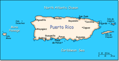
Official Name: Commonwealth of Puerto Rico Location: Caribbean, island between the Caribbean Sea and the North Atlantic Ocean, east of the Dominican Republic. Capital: San Juan
Lowest point: Caribbean Sea 0 m Highest point: Cerro de Punta 1,338 m |
|
||||||||||||
|
Population: 3,944,259 (July 2007 est.) Nationality: Puerto Rican(s) (US citizens) Ethnic groups: White (mostly Spanish origin) 80.5%, black 8%, Amerindian 0.4%, Asian 0.2%, mixed and other 10.9%. Religions: Roman Catholic 85%, Protestant and other 15%. Languages: Spanish, English. |
|
Tropical marine. Mild with little seasonal temperature variation |
|
Government type: Commonwealth (associated with the United States) Independence: None (commonwealth associated with the United States) National holiday: U.S. Independence Day, 4 July (1776) |

